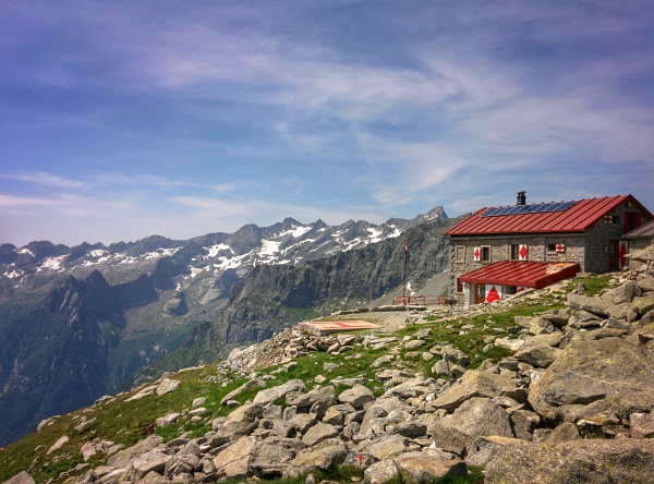
The Rifugio Gianetti (or rifugio Luigi Gianetti) is located in high Val Porcelizzo, 2534m. In my opinion is one of the most spectacular trail of Val Masino. Big elevation gain.

Shortly:
- Elevation gain: 1372 m.
- Hiking time: 3-4 hours
- Difficulty: Moderate
- Elevation: 2534 m.
- Trail: without number but well marked by white and red signs
Warning:
Trekking is an inherently dangerous activity. The hike here described can be a dangerous activity if faced without the right preparation. Mountain conditions can be very dramatically from one season to the next. Always seek local advice on current conditions, check the weather and don’t take anything for granted.
The author accepts no liability whatsoever for any loss, injury or inconvenience resulting from the use of this blog.
Starting point:
Bagni di Masino, 1172 m.
Drive through Val Masino to San Martino and then continue on the left until the end of the road. The parking area is limited and the lot fills early.
Trail description:
From Bagni di Masino parking area, walk to the flat trail in the forest (leaving the thermal baths on your right) until you’ll reach two trail junctions: to the left Rifugio Omio, to the right Rifugio Gianetti.
Take right. The trail begins with a steep slope on an old paved road. After that, you pass through a characteristic passage between the rocks and in 2 hours you’ll reach a plain at 1899 m.
Cross a footbridge, the trail continues through a long climb to a moraine, with an inviting view of the Rifugio Gianetti that you’ll reach after 3-4 hours from starting point.
Descent:
Along the same trail, although many alternatives are possible by connecting other trails.

Connected trail:
The climb is very long, so I recommended, to those who want hike down the same day, just to visit the refuge surroundings.
More:
For info on opening times visit the Rifugio Gianetti website (not ufficial)
Recommended Map: Kompass n°92
More hiking Val Masino
Sere
